
Turn abandoned patents
into your own filing
into your own filing
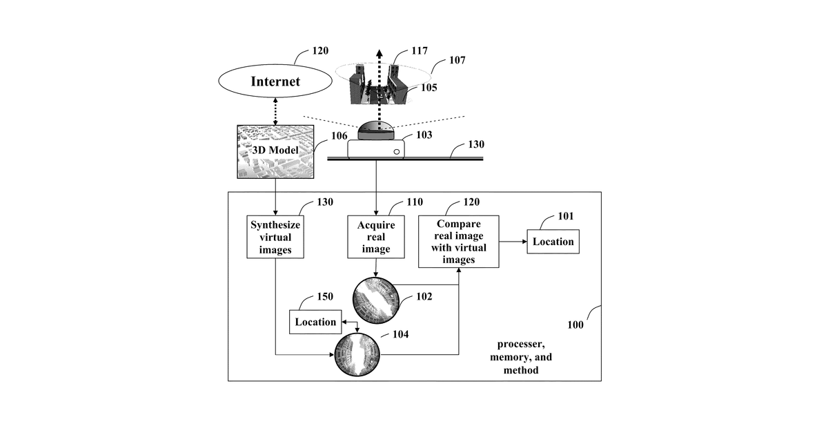
This invention helps you figure out where you are and which way you're facing by looking at the skyline. It takes a full 360-degree picture of the real urban skyline around you. Then, it compares this picture to a collection of computer-generated 360-degree pictures of known urban skylines from a 3D map, extracting features from the images to find the closest match, which reveals your exact spot and direction.
Why it matters: Filed before deep learning revolutionized image recognition and 3D city models became widely available. Modern GPUs and AI make synthesizing and matching images far more efficient and accurate.
AI gives you a few directions you could take this. Pick one, and we check whether your version is different enough to patent, then write the filing.
Reinvent this with AI


