
Turn abandoned patents
into your own filing
into your own filing
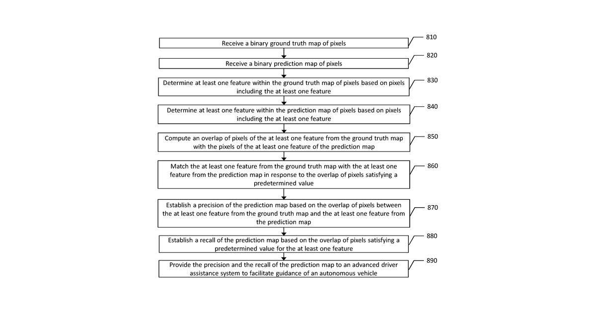
This invention describes a way to measure how accurate a computer system is at identifying specific features, like lane lines on a road, within an image. It works by comparing the computer's prediction of where those features are (a "prediction map" of pixels) against a perfect, correct map of where they actually are (a "ground truth map"). The system calculates how much the predicted features overlap with the correct ones. If the overlap is good enough, it considers them a match and uses this to determine the precision of the computer's prediction.
Why it matters: The rapid advancement and deployment of AI-driven perception systems in autonomous vehicles since 2017 has made precise, automated evaluation of pixel-level accuracy for safety-critical features like lane lines more essential than ever for development and regulatory compliance.
AI gives you a few directions you could take this. Pick one, and we check whether your version is different enough to patent, then write the filing.
Reinvent this with AI


